


Winnebago Precinct, Thurston County, Nebraska
About
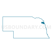
Outline

Summary
| Unique Area Identifier | 613983 |
| Name | Winnebago Precinct |
| County | Thurston County |
| State | Nebraska |
| Area (square miles) | 64.28 |
| Land Area (square miles) | 63.41 |
| Water Area (square miles) | 0.87 |
| % of Land Area | 98.65 |
| % of Water Area | 1.35 |
| Latitude of the Internal Point | 42.23461180 |
| Longtitude of the Internal Point | -96.44408610 |
Maps


Graphs
Select a template below for downloading or customizing gragh for Winnebago Precinct, Thurston County, Nebraska


Neighbors
Neighoring Voting District (by Name) Neighboring Voting District on the Map
- Anderson-Blackbird Precinct, Thurston County, NE
- FAIRVIEW TWP Voting District, Monona County, IA
- Flournoy/Merry Precinct, Thurston County, NE
- LAKEPORT TWP Voting District, Woodbury County, IA
- Omadi Precinct, Dakota County, NE
- Omaha Precinct, Thurston County, NE
Top 10 Neighboring County Subdivision (by Population) Neighboring County Subdivision on the Map
- Winnebago township, Thurston County, NE (1,922)
- Blackbird township, Thurston County, NE (1,319)
- Omaha township, Thurston County, NE (1,204)
- Omadi precinct, Dakota County, NE (1,040)
- Lakeport township, Woodbury County, IA (163)
- Fairview township, Monona County, IA (136)
- Merry township, Thurston County, NE (76)
Top 10 Neighboring Place (by Population) Neighboring Place on the Map
Top 10 Neighboring Unified School District (by Population) Neighboring Unified School District on the Map
- Westwood Community School District, IA (3,288)
- Winnebago Public Schools, NE (1,917)
- Emerson-Hubbard Public Schools, NE (1,861)
- Homer Community Schools, NE (1,661)
- Walthill Public Schools, NE (1,364)
Top 10 Neighboring State Legislative District Lower Chamber (by Population) Neighboring State Legislative District Lower Chamber on the Map
Top 10 Neighboring State Legislative District Upper Chamber (by Population) Neighboring State Legislative District Upper Chamber on the Map
- State Senate District 28, IA (56,661)
- State Senate District 17, NE (36,601)
- State Senate District 16, NE (31,475)
Top 10 Neighboring 111th Congressional District (by Population) Neighboring 111th Congressional District on the Map
Top 10 Neighboring Census Tract (by Population) Neighboring Census Tract on the Map
- Census Tract 9401, Thurston County, NE (4,400)
- Census Tract 35, Woodbury County, IA (4,033)
- Census Tract 104, Dakota County, NE (3,433)
- Census Tract 9402, Thurston County, NE (2,540)
- Census Tract 9602, Monona County, IA (2,086)
- Census Tract 9402, Woodbury County, IA (0)
Top 10 Neighboring 5-Digit ZIP Code Tabulation Area (by Population) Neighboring 5-Digit ZIP Code Tabulation Area on the Map
- 68071, NE (1,934)
- 68039, NE (1,421)
- 51055, IA (1,319)
- 68067, NE (1,288)
- 68733, NE (1,286)
- 51052, IA (1,027)
- 68030, NE (835)
- 68741, NE (790)